Английский Технологии
05.09.2026 Читать источник
Разработчик KDE подвел итоги конференции OpenStreetMap в Париже
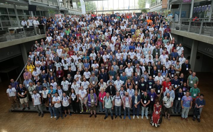
Автор презентации проекта Transitous рассказал о позитивном приеме со стороны французских транспортных операторов и обсудил новые подходы к отображению дорожных перекрытий. В ходе мероприятия также были отмечены важность открытости данных для государственных служб и необходимость международного обмена опытом.
Перевод ИИ
Текст статьи доступен на языке оригинала.
Нажмите кнопку «Перевести статью» выше, чтобы сгенерировать перевод с помощью ИИ.
Оригинальный контент
State of the Map 2026
Last week I attended this year’s State of the Map (SotM) in Paris, France,
OpenStreetMap’s annual conference.
This was actually my first time making it to SotM since I started working with OSM data for
KDE Itinerary eight years or so ago.
All links to talks below go the their abstracts, video recordings are still being added to the
OSM FR Peertube instance at the time of writing.
Public Transport
On Saturday I had the chance to present Transitous,
right after Felix’s and Robin’s talk about MOTIS,
the routing engine we use in Transitous.
Transitous also got mentioned in a couple of other talks, including Cartes announcing integration with Transitous
and CoMaps announcing work towards that as well. Overall we got very positive
feedback for Transitous.
SotM being in Paris also meant there were a number of participants and presentations from SNCF
and wider French public transport ecosystem. This also once again demonstrated why we need things like
the Open Transport Community Conference, unsurprisingly a lot of challenges in this field exist
in all countries and more international exchange could avoid some duplicated efforts.
Outside of the conference program there were also a few discussions on how to move specific topics in Transitous
forward, such as integration with Citybikes or improving GTFS data deduplication
and measuring GTFS feed overlap.
Indoor Mapping
SotM allowed me to meet a few people in real life that I had only
encountered online in the quarterly online OSM indoor meetup so far.
The work Antoine is doing on train stations or
Gwenaëlle is doing on accessibility and universities
isn’t “just” mapping, it’s also pushing modelling and tagging schemes in OSM forward.
I also got a chance to talk to the team from Sozialhelden about their
ongoing work on elevator status data (realtime disruptions and planned maintenance times),
and how we could move forward with matching that to OSM data. That’s a prerequisite for
integrating elevator status data into Transitous, an eagerly awaited feature there given the huge impact this has on wheelchair routing.
A rather different but also important topic was QA tooling for indoor mapping.
For OSM in general there’s not only a number tools but also quite some research
on e.g. reachability or completeness metrics. For indoor spaces this is still largely uncovered,
so it was good to see lightning talks in the scientific track on that.
Yet another topic that came up was the documentation, training and onboarding story
for indoor mapping. Even some very experienced OSM mappers see indoor mapping apparently
as hard and unapproachable, something easy to lose sight of when stuck
deep in modelling and tagging issues.
Dynamic OSM
Since the discussions at the FOSSGIS conference
and the discoveries presented at Grazer Linuxtage
earlier this year the momentum around dynamic (traffic) data keeps building, there was a packed BoF session on this
at SotM as well.
There’s a very broad interest in this, besides the usual suspects like the FOSS routing engines and map/navigation apps
there were a number of national agencies present and indicating their support for an open solution,
as well as firefighters unhappy with Google routing them around accidents while actually needing to go towards them.
There’s currently three approaches being developed:
OSM Road Closures by SOSM, focusing on (crowd-sourced) road closure tracking and being modeled around OpenLR.
“OSM-RT” by the MOTIS team, inspired by GTFS-RT
and OSM changesets, provding a dynamic layer on top of OSM using the existing OSM data models, identifiers and tagging schemes
(not unlike what we do for Kongress as well).
OpenEventDatabase, modeled around GeoJSON geometry and a generic tagging scheme.
Those aren’t necessarily competing, but complement each other. OpenEventDatabase shows that there’s usecases for this
way beyond traffic data, OSM-RT looks like an elegant and efficient way to distribute and combine dynamic data feeds from different sources
into applications, and both crowd-sourcing and integrating existing official data probably needs a more domain-specific view as adopted
by the OSM Road Closure database.
One concrete outcome of the BoF session is that there’s no a Matrix channel
for coordinating work around dynamic OSM data,
as this probably only has a chance of gaining critical mass and going anywhere if we manage to align all this. That remains hugely
ambitous of course, but seeing how eager people and organizations seem to be to break free of the monopolies
in this area, this might actually work out.
KDE Integration
There’s also a few outcomes that immediately benefit users of various KDE apps:
The SotM venue had indoor mapping usable by Kongress, resulting in a few fixes for this.
Kongress can now also add talks or sessions directly to your system calendar (on Linux and Android).
Unfortunately no doors were mapped in the venue, which meant we couldn’t test the built-in routing in Kongress.
Itinerary and KTrip now filter out service alerts
for (planned) events way outside of your time of travel,
such as future construction work. This makes results in Paris a bit more readable, where there’s service alerts
for works up to half a year into the future.
We now have a geo: URI handler for Cartes built in, so you can select that in System Settings
as the default map ( MR 233, part of KF 6.30).
I had previously failed to figure out the details for this, after talking to the Cartes team it was just a matter of a few minutes.
And more
All of this is barely scratching the surface of SotM, the topics and the community are far broader than this.
Seeing talks on how software and data from the OSM community is essential for emergency services,
or helped during the response to the recent earthquakes in Venezuela
show how much real-world impact what we do can have.
Hearing the head of the French National Geographic Institute (IGN)
very explicitly state in his closing remarks that (digital) sovereignty
can only be achieved by openness and collaboration rather than by closing down and adding borders was also encouraging,
many public agencies have yet to understand that.
SotM was my start into the conference season, two other major events for me follow in quick succession now,
KDE Akademy in Graz, Austria in just two weeks, and the
Open Transport Community Conference early October in Bern, Switzerland.
Аналитика ИИ и парсинга
Технические детали обнаружения, сопоставления и связывания статьи
Поисковый запрос
«KDE разработчик OpenStreetMap конференция Париж»
Запрос, сгенерированный ИИ для поиска статьи в веб-источниках
Связанные результаты поиска
Aug 28, 2026 · Ежегодная конференция State of the Map, посвященная OpenStreetMap, в 2026 году пройдет в Париже и онлайн с 28 по 30 августа. Мероприятие соберет мапперов, разр…