Английский Экология
03.09.2026 Читать источник
Компания Near Space Labs провела аэрофотосъемку берегов Мексиканского залива с высоты 45 тысяч футов
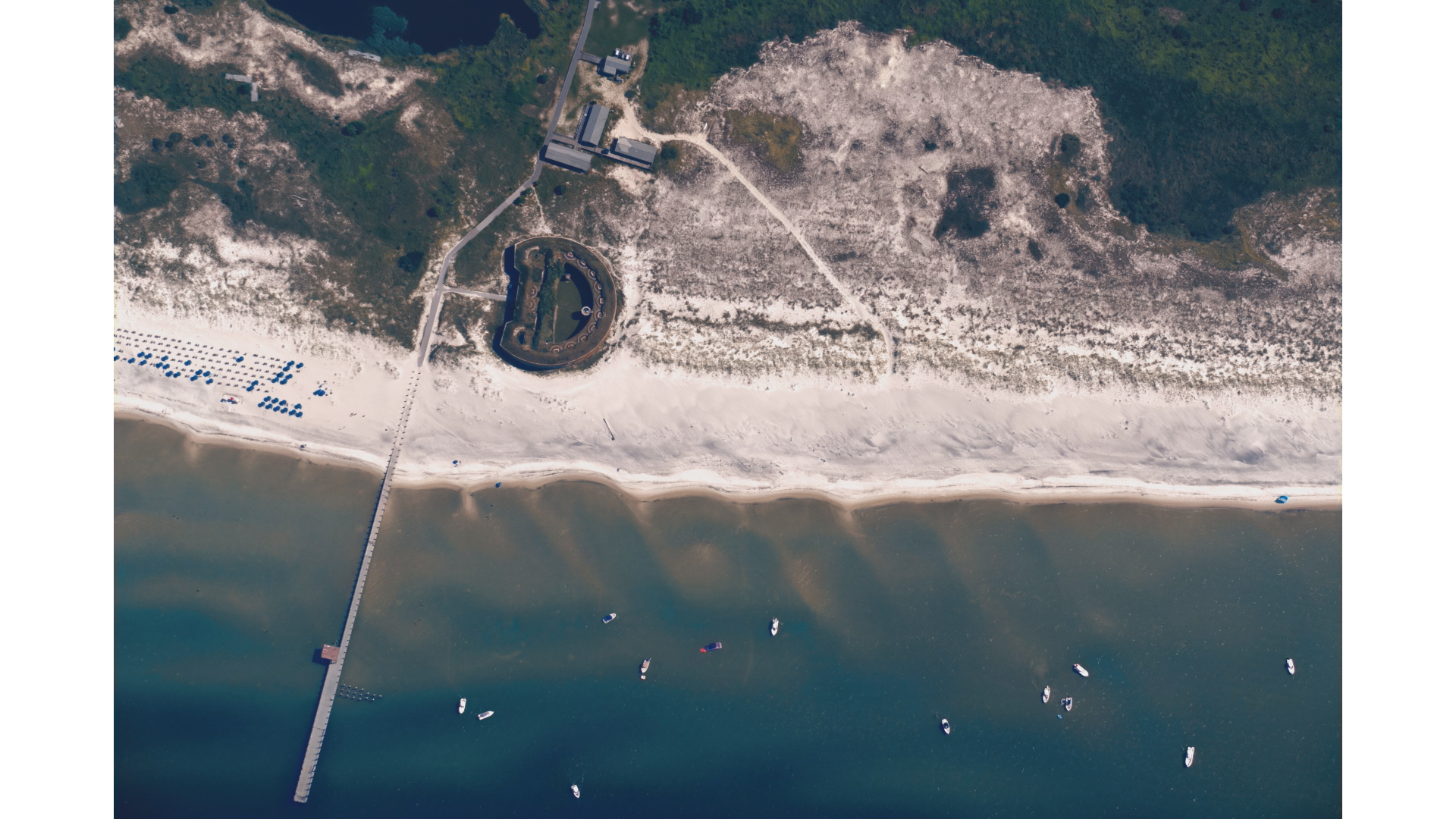
Частная компания Near Space Labs в партнерстве с Университетом Южной Миссисипи зафиксировала состояние береговых линий штатов Миссисипи и Луизиана с высоты 45 тысяч футов. Полученные данные помогут государственным агентствам оптимизировать расходы на восстановление эродированных пляжей и защиту от штормов.
Перевод ИИ
Текст статьи доступен на языке оригинала.
Нажмите кнопку «Перевести статью» выше, чтобы сгенерировать перевод с помощью ИИ.
Оригинальный контент
Company maps Gulf Coast shorelines from 45,000 feet during hurricane season
GULFPORT, Miss (WVUE) - Near Space Labs, a private, U.S.-based aerial imagery and geospatial data company, has partnered with the University of Southern Mississippi’s Gulf Blue to map Gulf Coast shorelines from miles above the ground.
“That’s the goal, is to match the data collection with the rate of change that’s happening,” said Alex Kapur, Near Space Labs.
An autonomous Swift vehicle climbed to about 45,000 feet in mid-August, capturing high-resolution imagery across roughly 772 square miles.
Kapur, Near Space Labs business development senior vice president, documented coastlines, wetlands, ports, barrier islands and inland areas across Mississippi and Louisiana.
“Two-thousand square kilometers over a period of three hours — the Louisiana wetlands, barrier islands, the coastline, various shoreline assets such as ports,” Kapur said.
“It’s gonna take us about a few weeks to fully produce the results of the survey so we can see and interpret exactly what we saw,” Kapur said.
“It’s very helpful making decisions — being able to see the big picture,” said Joel Lawhead, Gulf Blue Navigator program manager.
Lawhead said updated imagery is important as storms and erosion continue to reshape the coast.
“The Near Space Labs Swift system lets us map with a resolution of a satellite over a broad area and then do it at a cost that’s less than doing it with an airplane or even drones in some cases,” Lawhead said.
Near Space Labs said some Gulf Coast shorelines are washing away by as much as 60 feet a year.
The company said it plans to share its updated imagery with more than 20 federal, state and local agencies to help guide decision making.
Lawhead said this information could influence future spending on beach restoration, barrier islands, storm protection and coastal development.
“Being able to decide where to spend money, where the important areas are to do that, this technology really helps with that, and does it very affordably,” Lawhead said.
See a spelling or grammar error in our story? Click Here to report it. Please include the headline.
Subscribe to the Fox 8 YouTube channel.
Copyright 2026 WVUE. All rights reserved.
Аналитика ИИ и парсинга
Технические детали обнаружения, сопоставления и связывания статьи
Поисковый запрос
«Near Space Labs аэрофотосъемка Мексиканский залив»
Запрос, сгенерированный ИИ для поиска статьи в веб-источниках
Связанные результаты поиска
Трампапроводит очередной аукцион по продаже лицензий на разработку нефтегазовых ресурсов на континентальном шельфев Мексиканском заливе. На торги будет выставлено более 81 млн акров (около 32,8 млн га). Об этом сообщает Reuters.